Maps/Landkarten Deutschland
Die Liste enthält 23 Einträge. Suchergebnisse löschen und Gesamtbestand anzeigen.
| Abbildung |
Beschreibung Stichwort, Autor, Titel, Buchbeschreibung |
Preis EUR |
|
|---|---|---|---|
 |
Deutschland: Railway: Schieneverkehr: Eisenbahn: Map of Central Europe, embracing Germany, Holland, Belgium, with parts of France & Switzerland; showing the roads, canals and railways. Lithografie von W. Hughes, um 1860 erschienen. London & Edinburgh. 42 x 61 cm. Gut erhalten. | 45,-- |  |
 |
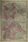
Deutschland: Landkarte: Johnson´s Germany. Kolorierte Lithografie bei Johnson und Ward in New York erschienen. Coloured lithograph published by Johnson and Ward in New York, 1864. Bildformat: 61 x 39,5 cm. Gut erhalten. | 90,-- |  |
 |
Norddeutschland: Johnson´s Germany. Kolorierte Lithografie bei Johnson und Ward in New York erschienen. Coloured lithograph published by Johnson and Ward in New York, 1864. 32 x 39,5 cm. 35 x 44,5 cm. Links am Rand wenige Stockflecken, sonst gut erhalten. | 90,-- |  |
|
Einträge 21–23 von 23
Zurück · Vor
|
|||
Sortiert nach: Autor · Titel · Katalogsortierung · Erscheinungsjahr · Preis · Letzte Änderung · Relevanz
HescomShop - Das Webshopsystem für Antiquariate und Verlage | © 2006-2024 by HESCOM-Software. Alle Rechte vorbehalten.
