
Koloriert
Die Liste enthält 370 Einträge. Suchergebnisse löschen und Gesamtbestand anzeigen.
| Abbildung |
Beschreibung Stichwort, Autor, Titel, Buchbeschreibung |
Preis EUR |
|
|---|---|---|---|
 |
Nordafrika: Kaiserreich Abessinien: CARTE DÉTAILLÉE en deux feuilles DE L´AFRIQUE et des ILLES QUI EN DEPENDENT Grenzkolorierter Stahlstich nach Adrian-Hubert Brué bei Barthelemier in Paris, 1858. 36 x 50,5 cm Karte. 52 x 70 cm Blatt. Gut erhalten. | 100,-- |  |
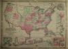 |
USA: Map: Military: Johnson´s New Military Map of the United States. Showing the Forts, Military Posts & c. with … Kolorierte Lithografie bei Johnson und Ward in New York erschienen. Coloured lithograph published by Johnson and Ward in New York, 1864. 44 x 60,5 cm inkl Bordüre. Gut erhalten. | 220,-- | |
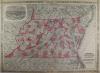 |
USA: Maryland: Delaware: Maryland: Johnson´s Virginia Delaware and Maryland. Kolorierte Lithografie bei Johnson und Ward in New York erschienen. Coloured lithograph published by Johnson and Ward in New York, 1864. 44,5 x 61 cm inkl. Bordüre. Gut erhalten. | 180,-- | |
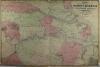 |
USA: Vicinity of Richmond: Peninsular Campaign in Virginia: Johnsons Map of The Vicinity of Richmond, Peninsular Campaign in Virginia. Kolorierte Lithografie bei Johnson und Ward in New York erschienen. Coloured lithograph published by Johnson and Ward in New York, 1864. 45 x 67 cm. Etwas knaprandig, sonst gut erhalten. | 180,-- | |
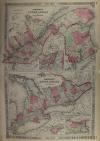 |
Canada: Johnson´s Lower Canada and New Brunswick – Upper Canada. Kolorierte Lithografie bei Johnson und Ward in New York erschienen. Coloured lithograph published by Johnson and Ward in New York, 1864. Bildformat: 61 x 40 cm. Gut erhalten. | 140,-- | |
 |
North America: Mexico: Johnsons North America. Kolorierte Lithografie bei Johnson und Ward in New York erschienen. Colored lithograph published by Johnson and Ward in New York, 1864. 56 x 43,5 cm inkl. Bordüre. Wenig fleckig, Mittelfaz links und rechts je 3 cm hinterlegt, sonst gut erhalten. A little bit stained, centrefacet backed 3 cm each left and right, otherwise well preserved. | 200,-- | |
 |
Deutschland: Rheinkarte: Oettinger. Charte Geographique de la Campagne du Haut Rhin … Kolorierter Kupferstich von Johann Friedrich Oettinger bei Matthäus Seutter in Augsburg erschienen, um 1740. 49,3 x 58 cm. Mittelfalz unten ca. 5 cm aufgeplatzt, etwas fleckig. Insgesamt gut erhalten. | 300,-- | |
 |
Ober- und Mittelfranken: Franken: Frankenland: Circuli Franconiae pars orientalis et potior novissime delineata. Altkolorierter Kupferstich bei Johann B. Homann, mit Privileg, nach 1729 erschienen. 55 x 48,6 cm. Am Rand Stockflecken und etwas Wasserrandig, sonst gut erhalten. | 250,-- | |
 |
Postroutenkarte: Postal route map: Homann. Neu-vermehrte Post-Charte durch gantz Teutschland nach Italien, Franckreich, Niederland, Preußen, Polen, und Ungarn ec. Altkolorierter Kupferstich nach Johann Peter Nell bei Johann Baptist Homann in Nürnberg, nach 1729 da mit Privileg. Old coloured copper engraving after Johann Peter Nell by Johann Baptist Homann in Nuremberg, after 1729 da mit Privileg. 46,3 x 58 cm. Mittelfalz restauriert, unten einige Einriße allesamt hinterlegt. Sonst prima erhalten. Centrefold restored, some tears at lower margin all backed. Otherwise well preserved. | 400,-- | |
 |
Schwaben: S.R.I. Circulus Sueviae continens Ducatum Wirtenbergensem. altkolorierter Kupferstich bei Joahnn B. Homann, mit Druckprivileg. nach 1729. 48,5 x 55,2 cm. Breitrandiges Blatt, wenige Flecken mit schönem Kolorit, gut erhalten. | 340,-- | |
|
Einträge 311–320 von 370
|
|||
Sortiert nach: Autor · Titel · Katalogsortierung · Erscheinungsjahr · Preis · Letzte Änderung · Relevanz
HescomShop - Das Webshopsystem für Antiquariate und Verlage | © 2006-2026 by HESCOM-Software. Alle Rechte vorbehalten.