
Griechenland
The catalog contains 6 items. Drop search results and show the complete catalog.
| Image |
Description Subject, Author, Title, Bibliography |
Price EUR |
|
|---|---|---|---|
 |
Altes Griechenland: Ägypten: Grèce Ancienne.Égypte Ancienne. Kolorierter Stahlstich von Jenotte nach Drioux und Leroy, 1874. 29,5 x 43 cm. Gut erhalten. | 40,-- |  |
 |
Griechenland: Kreta: Blaeu. Candia olim Creta Altkolorierter Kupferstich von W. Blaeu, um 1630. Old coloured copperplate engraving by W. Blaeu, around 1630. 38 : 52,5 cm. Blattformat: 54,5 : 61,3 cm. Wurmspuren im äußersten Rand. Die Karte ist insgesamt gut erhalten. Zacharakis/Scutari 386/247; Koeman II, 7900:2. | 850,-- | |
 |
Südosteuropa: Adriaküste: Rumänien: Griechenland: Seutter. Theatrum belli sive novissima tabula qua maxima pars Danubii et præsertim Hungaria cum aliis adiacentibus regnis; nec non Græcia, Morea, et Archipelagi insulæ accurate delineantur Excusa et venalis exposita À Matthaeo Seutter. Altkolorierter Kupferstich von Matthäus Seutter, um 1730. 49,5 x 58 cm. Die Mittelfalz leicht leimschattig, sonst sehr gut erhalten. Deutscher Kunstverlag “Die Welt aus Augsburg” | 450,-- | |
 |
Südosteuropa: Griechenland: CARTE GÉNÉRALE de la TURQUIE D´EUROPE. Grenzkolorierter Stahlstich nach Adrian-Hubert Brué bei Barthelemier in Paris, 1858. 50,5 x 36,4 cm Karte. 70 x 52 cm Blatt. Gut erhalten. | 180,-- | |
 |
Südosteuropa: Osmanisches Reich: Imperii Osmanici sive Turcici Europaei tabula ad normam Recentissimarum Observationem concinnata Sumtibus joannis Walchii. Das Osmanische Reich in Europa nach den neuesten Nachrichten … Kupferstich bei Johann Walch, um 1820. 49 x 58 cm, Neben der Titelkartusche ein großer Fleck, etwas knittrig & knapprandig, oben Einriß von 1,5 cm. | 230,-- | |
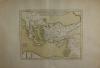 |
Türkei: Syrien: Griechenland: Delisle. Tabula Geographica Provinciarum et Urbium. Kupferstich von Guillaume Delisle bei Phillipe Buache, 1745 datiert, erschienen 1776. 33,5 x 41,5 cm, gut erhalten. | 200,-- | |
|
Entries 1–6 of 6
Previous · Next
|
|||
| Page: 1 |
HescomShop - Das Webshopsystem für Antiquariate und Verlage | © 2006-2026 by HESCOM-Software. Alle Rechte vorbehalten.